Vegetation Cover
Overview
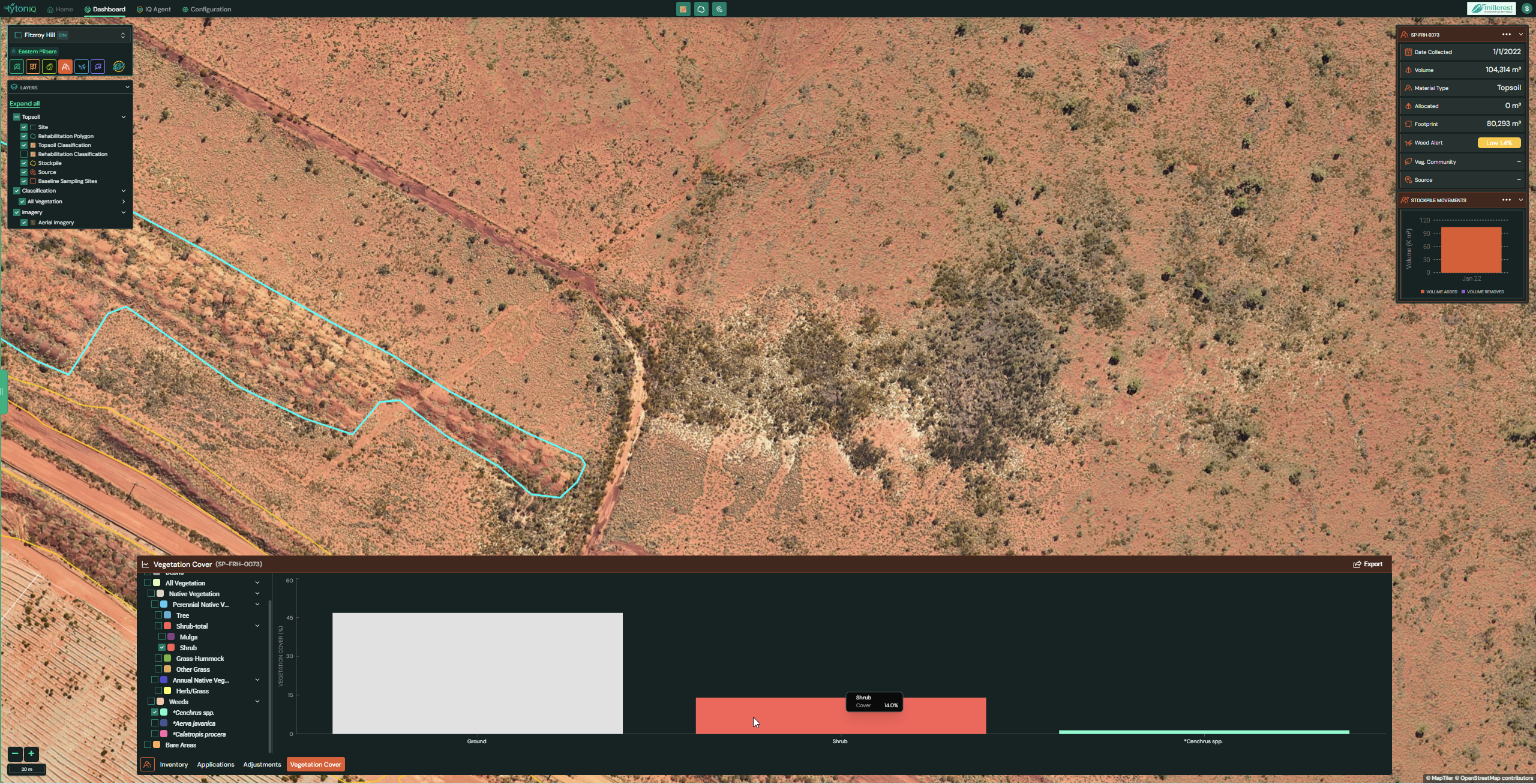
The Topsoil Vegetation Cover module in TytonIQ provides a detailed visual assessment of vegetation composition within polygons associated with topsoil stockpiles. This module is designed to support ecological monitoring by analysing how vegetation establishes on or around stockpiles over time, with particular focus on native species and weed dynamics.
Key Features
-
Vegetation Classification
Vegetation is grouped into ecological categories that can be tailored to each customer environment.- Categories may include native vegetation groups, weed species, ground cover types, or other site-specific classifications.
- The categories available will depend on how vegetation surveys and classifications have been configured in TytonIQ for the project site.
These categories can be toggled on or off for clearer analysis.
-
Interactive Cover Graph
- The bar graph at the bottom of the interface displays vegetation cover by class for the selected polygon.
- Hovering over a bar segment reveals the exact percentage value for that vegetation type (e.g., Shrub Cover: 14%).
- Multiple classes can be viewed at once to understand balance between native vegetation, weeds, and bare areas.
-
Polygon Integration
- Vegetation cover is linked directly to the selected polygon (highlighted in turquoise on the map).
- The right-hand panel provides context, including polygon volume, footprint, weed alerts, and source information.
-
Dynamic Analysis
- Users can filter vegetation classes on the left panel to refine the chart view.
- The module enables assessment of vegetation conditions at a single point in time or comparison across surveys when multiple records are available.
Usage Scenarios
-
Stockpile Health Monitoring
Review vegetation cover on stockpile surfaces to assess whether they are stabilising as expected or showing signs of erosion. -
Weed Risk Assessment
Identify the extent of weed cover across stockpiles and surrounding polygons, supporting targeted weed management strategies. -
Rehabilitation Performance Tracking
Monitor how vegetation is establishing on areas where topsoil has been applied, comparing outcomes against rehabilitation targets. -
Comparison Across Stockpiles
Compare vegetation cover between multiple stockpiles to prioritise management efforts or evaluate differences in soil quality. -
Erosion Control Review
Assess whether vegetation cover is sufficient to protect stockpiles from wind or water erosion, and identify areas needing intervention. -
Compliance and Reporting
Generate visual outputs for inclusion in rehabilitation reports, demonstrating how vegetation is progressing on topsoil resources over time.