Species Sampling
Overview
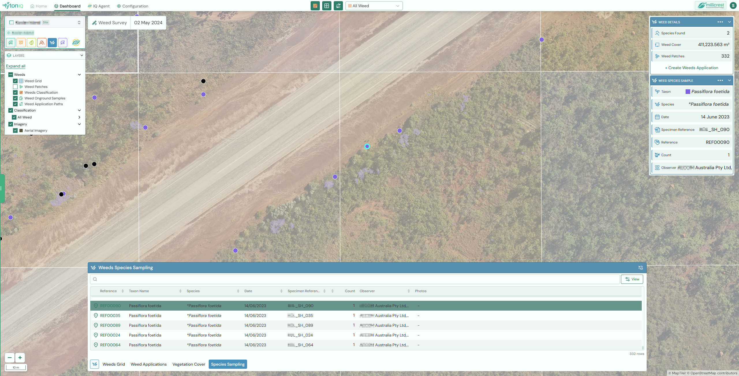
The Weeds Species Sampling module in TytonIQ provides detailed survey information on individual weed species recorded across a project area. Each recorded sample is georeferenced, colour-coded, and linked to specimen details, ensuring traceability and supporting effective weed management strategies.
Key Features
-
Map Visualisation
- Each weed species sample is represented as a coloured dot on the map.
- Colours are unique to each species, allowing quick visual differentiation.
- Samples can be overlaid with other weed survey layers, such as grids and patches, to provide full spatial context.
-
Interactive Selection
- Selecting a row in the Species Sampling table highlights the corresponding sample on the map imagery.
- This ensures direct correlation between tabular data and spatial distribution.
-
Bottom Drawer Table
- The sampling table lists all survey records, including:
- Reference ID
- Taxon name and species
- Date of survey
- Specimen reference
- Observer details
- Count of individuals
- Supports sorting and filtering to quickly locate specific species or records.
- The sampling table lists all survey records, including:
-
Detailed Information Panel
- The right-hand card displays detailed metadata for the selected sample, including:
- Taxon and species
- Specimen reference
- Survey reference
- Date and observer
- Count of individuals recorded
- Provides a single location for reviewing specimen-level details without leaving the map view.
- The right-hand card displays detailed metadata for the selected sample, including:
Usage Scenarios
-
Species Verification
Confirm field survey identifications and specimen records at precise locations across the project area. -
Targeted Weed Management
Identify the presence of high-priority invasive species and plan control activities at the exact sites where they occur. -
Survey Auditing
Cross-check survey data, including specimen references and observer details, for quality assurance and audit purposes. -
Change Detection
Compare records across multiple surveys to detect the spread, persistence, or reduction of specific weed species. -
Reporting
Export sampling records for inclusion in environmental assessments, rehabilitation progress reports, or regulatory submissions.
Summary
The Weeds Species Sampling module provides fine-scale detail on weed presence across survey areas. By integrating map visualisation, specimen metadata, and tabular records, it ensures survey data is accurate, traceable, and actionable for weed management and compliance reporting.